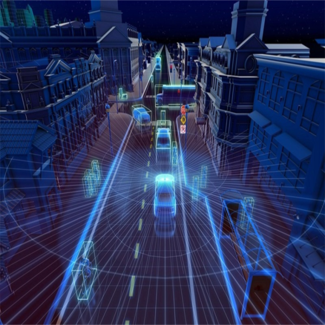
In optical measurement and sensing technology, Laser Range Finder (LRF) and LIDAR are two oft-cited terms that, while they both involve laser technology, differ significantly in function, application, and construction.
First of all in the definition of the perspective trigger, laser range finder, is an instrument to determine the distance to a target by emitting a laser beam and measuring the time it takes for it to reflect back from the target. It is mainly used to measure the straight line distance between the target and the rangefinder, providing accurate distance information. LIDAR, on the other hand, is an advanced system that utilizes laser beams for detection and ranging, and it is capable of acquiring three-dimensional position, speed, and other information about a target. In addition to distance measurement, LIDAR is also capable of providing detailed information about the direction, speed, and attitude of the target, and realizing environmental awareness by creating a three-dimensional point cloud map.
Structurally, laser rangefinders are usually composed of a laser transmitter, a receiver, a timer and a display device, and the structure is relatively simple. The laser beam is emitted by the laser transmitter, the receiver receives the reflected laser signal, and the timer measures the round-trip time of the laser beam to calculate the distance. But the structure of LIDAR is more complex, mainly composed of laser transmitter, optical receiver, turntable, information processing system and so on. The laser beam is generated by the laser transmitter, the optical receiver receives the reflected laser signal, the rotary table is used to change the scanning direction of the laser beam, and the information processing system processes and analyzes the received signals to generate three-dimensional information about the target.
In practical applications, laser rangefinders are mainly used in the need for accurate distance measurement occasions, such as building surveys, terrain mapping, navigation of unmanned vehicles and so on. The application areas of LiDAR are more extensive, including the perception system of unmanned vehicles, the environment perception of robots, cargo tracking in the logistics industry, and terrain mapping in the field of surveying and mapping.
Lumispot
Address: Building 4 #, No.99 Furong 3rd Road, Xishan Dist. Wuxi, 214000, China
Tel: + 86-0510 87381808.
Mobile: + 86-15072320922
Email: sales@lumispot.cn
Website: www.lumimetric.com
Post time: Jul-09-2024